Weather Fronts
What are Weather Fronts ?
A weather front is the boundary between two air masses. The air masses being cold and warm air. Along a front, there are likely to be large variations in temperature due the warm air coming into contact with cooler air. The difference in temperatures may be used to indicate the strength of the front. If very cold air comes into contact with very warm air, the front can be strong or intense. On the other side of the coin if the air masses are similar in temperature the front may be weak.
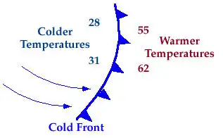
Cold Front
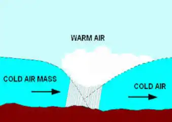
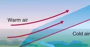
A cold front is defined as a mass of cooler air replacing warm air ahead of it. Cold fronts are associated with Low pressure systems. When enough moisture is present rain will form on the boundary. If the air is unstable enough Thunderstorms can form along the front. See the pictures below describing the cold front.
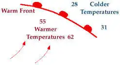
Warm Front
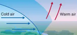
A warm front is a mass of warm air replacing cold air ahead of it. Since cold air is more dense Warm air rises above it. At times in Winter this can lead to freezing rain as rain falls through warmer air into cold air still at ground level.
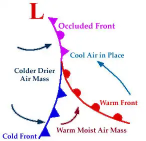
Occluded Front
An occluded front is where the cool air lifts the warm up above ground between two cool air masses. This is due tot he fact that cold air masses move faster than warm air masses. There are two types of Occlusion Warm and Cold. Cold occlusions are more common that the warm occluded fronts. Although these are rarely mentioned on the forecast what you will generally notice is that it either turns slightly cooler or milder depending on the type of Occlusion. Warm Occlusions are the most frequent causes of freezing rain in the UK where less cold air replaces the cold air but the ground surface is cold enough to allow the rain to freeze on contact. Cold Occlusions often follow cold fronts introducing a colder air mass. Occluded fronts are found with mature low pressure systems.